Canada is a vast, beautiful wonderland. Just by looking out my window I am reminded of exactly how beautiful Canada is. There’s endless gorgeous landscapes to admire. But you know what? Canada isn’t just a pretty place, it's also a little odd. In the spirit of exposing the fun and unusual facts about our fantastic geography, I’ve created a list of some of Canada’s weirdest bumps and lumps for you to enjoy. Because Canada’s got character.
The International Boundary
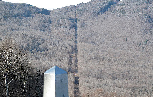
The line between the United States and Canada is famous for being the longest, straightest international border in the world between two countries, at 8,893 km. When they drew the original maps to divide Canada from the USA, while much of the east had been explored, very little of the west had been. People just weren’t sure what was out there so, they drew the line and commissioned a group to cut a straight corridor down the length of the line.
In those pre-GPS days, it was more than a little difficult to cut a perfectly straight line across a continent. When you look at the border from the sky, you can see it actually zigs and zags its way across.
The world’s largest island in a lake on an island in a lake on an island
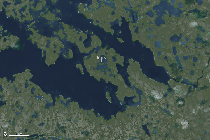
Take a minute to wrap your head around that one! An island inside a lake, that is completely surrounded by another island, which is then completely surrounded by another lake, which is situated in another island. This island was discovered by Ken Jennings (of Jeopardy! fame) in 2012, the recursive islands lie in Victoria Island, which happens to be is Canada’s second largest island!
Hans Island
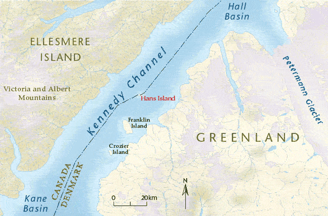
There are three islands in the Kennedy Channel (the body of water between Canada and Greenland) and Hans Island is the smallest, most unremarkable of them. It is a small, uninhabited, barren, lifeless little knoll that also happens to fall directly in the middle of a theoretical line that divides the channel between Canada and Greenland. Denmark has claimed the island on behalf of Greenland. Canada has claimed the island on the behalf of Canada. It is a tense, international dispute.
How to solve it? A B.Y.O.B party of course. For a while, Canadians and Danes took turns planting their respective flags, and leaving a bottle of their countries finest liquor for the other side to find. Nowadays the politics of the island have gotten a little more serious, but it’s good to know when it comes down to it, both sides are just here to have a good time.
Point Roberts
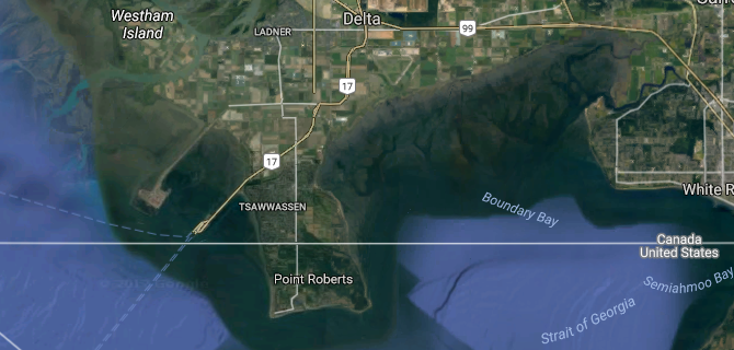
This little nub of land became one of the problems that the International Boundary line left behind. The point falls below the Canada/USA border, but it is only connected to Canada, in Tsawwassen. This means the Americans living there have no connection to mainland United States. The adults aren't affect too badly in daily life, but the elementary school only goes to grade four, so the American kids need to embark on a 40-minute bus ride through British Columbia to attend school in Blain, Washington.
The Manicouagan Crater
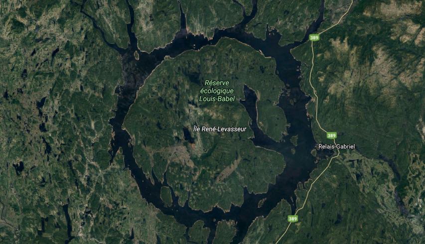
One of the oldest astroblemes (your welcome for introducing you to that word) on Earth, this crater is named after where it was found, the Manicouagan Regional Country Municipality in the Cote-Nord region of Quebec. Roughly 215 million years old and 100 kilometers across, this giant hole in the ground is thought to have been created by a 5 kilometer diameter asteroid or comet.